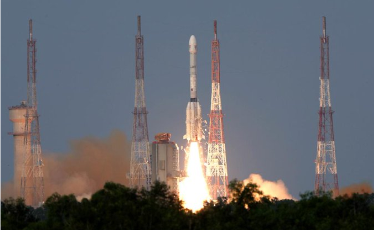
On 30 July 2025, the NASA-ISRO Synthetic Aperture Radar (NISAR) satellite was successfully launched from the Satish Dhawan Space Centre at Sriharikota in Andhra Pradesh. This satellite is the first of its kind, designed to enhance global monitoring of climate change and natural disasters and boost overall environmental research. The Geosynchronous Satellite Launch Vehicle (GSLV)-F16 rocket carrying the earth observation satellite lifted off from the second launch pad of the space centre at 5.40 p.m. IST. Eighteen minutes later, it injected the satellite into a sun-synchronous orbit.
The NISAR had been developed for over a decade and costs 1.5 billion dollars, making it one of the most expensive Earth-observing satellites to date. The NISAR programme is a landmark moment in global space diplomacy, facilitating the collaboration between NASA’s cutting-edge technology and India’s engineering expertise. Indian space industry representative Anil Prakash, Director General at SatCom Industry Association (SIA-India), hailed the NISAR mission and Indo-US space collaboration.
“With a legacy of over 400 international satellite launches, ISRO has emerged not just as a collaborator, but as a co-architect of next-generation Earth science missions,” he said.
NISAR marks the most advanced collaboration between NASA and ISRO, underscoring the growing trust and interdependence between the two global space powers. Furthermore, India’s emphasis on peaceful applications of its space technology for climate resilience, disaster prediction, agriculture, and water management reinforces its commitment to sustainable development over space militarisation.

Image Source: X/ @isro
NISAR is the first satellite to observe the Earth using a dual-frequency Synthetic Aperture Radar (SAR). This satellite will scan the entire globe twice every 12 days. This collaboration encapsulates NASA’s L-band and ISRO’s S-band radar systems — the L-band uses higher wavelength microwaves to cover vegetation, ice and sand, while the S-band captures crop fields and water bodies.
“NISAR can detect even small changes on the Earth’s surface, such as ground deformation, ice sheet movement, and vegetation dynamics. Further applications include sea ice classification, ship detection, shoreline monitoring, storm characterisation, changes in soil moisture, mapping and monitoring of surface water resources, and disaster response,” ISRO has stated.
By combining advanced radar imaging with climate and environmental monitoring, the mission demonstrates the power of international collaboration to drive practical and long-term solutions to global challenges, from climate change and natural disasters to resource management. This launch is not just a significant milestone in science but also a commitment to advancing space diplomacy through collaboration and impactful scientific progress.
Leave a Reply